
Bighorn Fire updates, New PZT
Posted: 26 June 2020
The Bighorn Fire, just a few miles south of Cassiopeia Observatory, continued to burn and grow on Tuesday, 23 June 2020. In the morning there was not much smoke visible on the mountain, but in the afternoon there was a lot more smoke, some from backburning operations by the firefighters.

Late Tuesday afternoon my replacement POD Zenith Table (PZT) was set up by the contractor and initial checks were done. The smoke from the Bighorn Fire and the temperature of 105°F made working outside rather exhausting. Some additional pieces need to be added before the new PZT is completed. The contractor left the frame and will return in a couple of weeks to complete the installation. The PZT is functional now but of course the smokey sky is keeping me out of the observatory.
Tuesday evening the fire was still at 65,536 acres burned with 33% containment. The power went off on the mountain again so the live webcam view from the Mt Lemmon Observatory went back offline.
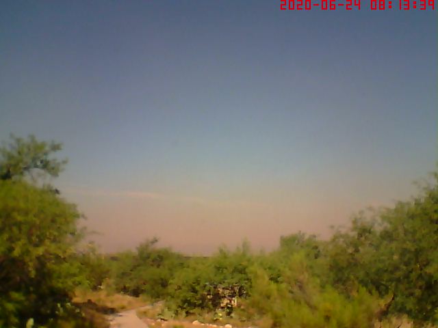
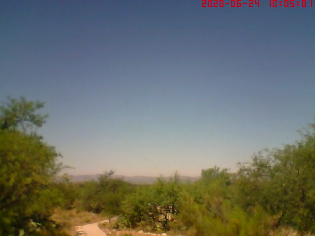
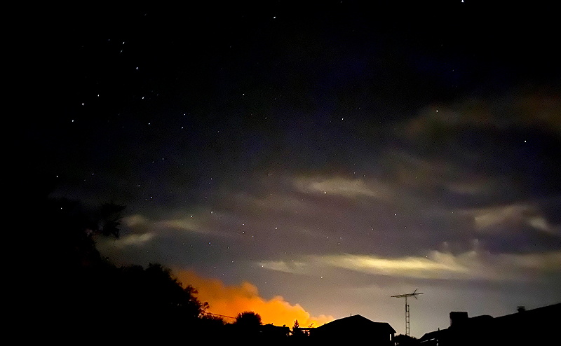
Wednesday morning, 24 June, the sky was clear with very little smoke visible when looking up. Unfortunately, the smoke had settled down to the ground overnight and could be smelled throughout the house. This view from our webcam looking west showed the smoke that had settled into the valley below us (top) and the view about 2 hours later when the smoke had lifted as the ground heated up from the rising Sun (bottom, with distant mountains visible).
The area burned increased overnight to 74,547 acres with 33% containment. Some cirrus clouds appeared during the day. The wind stayed fairly calm most of the day so there was little smoke visible in the sky mid-day. The wind was forecast to increase over the next few days; a concern for the firefighters. Wednesday evening there was widespread backburning operations just south of Oracle.
After dark the backburning fires were very evident across the region. Here's what I could see looking south from our land.

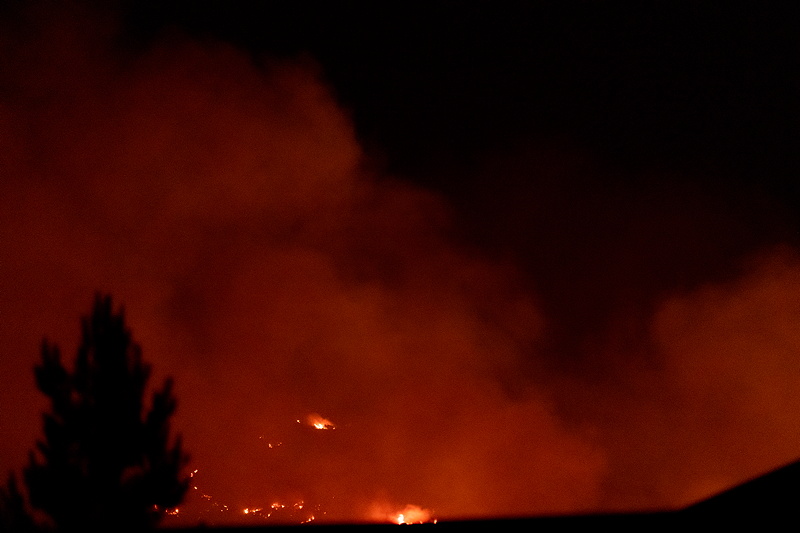
This handheld iPhone photo shows the smoke from the fires, some clouds, and stars with the constellation of Scorpius at the left.
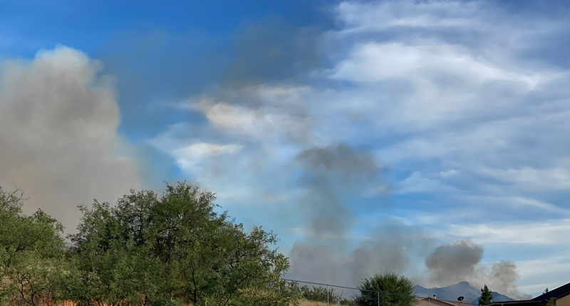
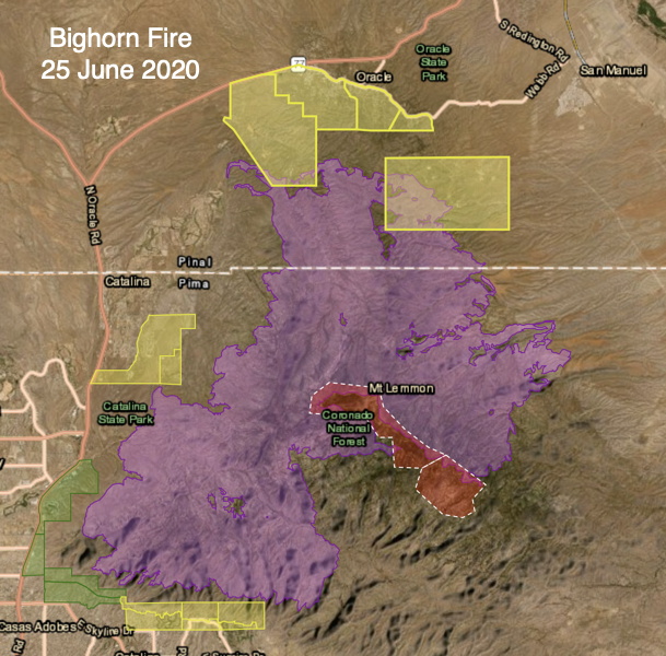
Thursday, 25 June, dawned with little smoke visible, but that changed in about 2 hours. By 0800 MST the air was filled with smoke and the smell became evident inside the house. The morning fire report said 81,702 acres had been burned, remaining at 33% containment. The overnight fire operations were successful. This fire map shows the burned areas (purple), and the evacuation statuses (red = GO, yellow = SET). Oracle and Oracle State Park are at the top.
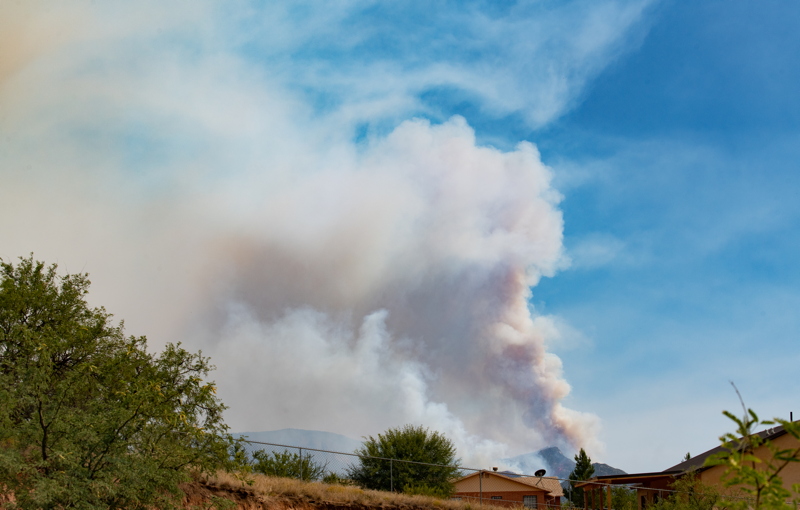
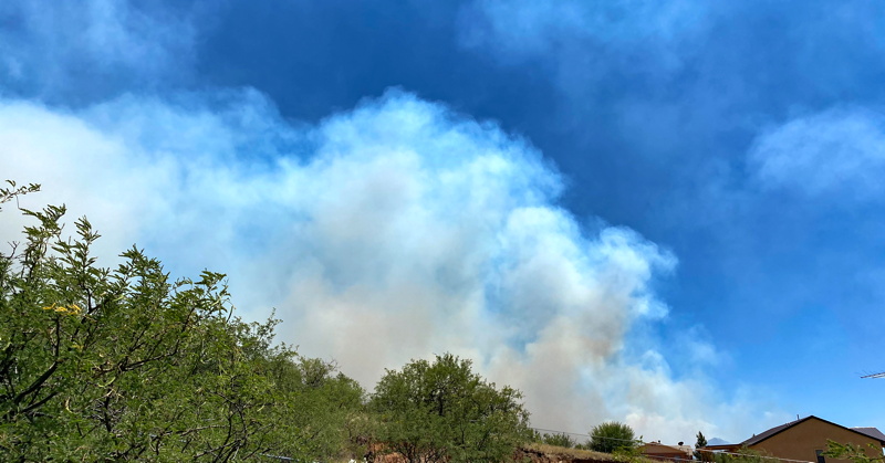
As expected the winds increased mid-day. The closest fire perimeter is now about 3 miles away. The view from here looked like this:
As sunset approached there was smoke, clouds, wind, but no rain. At 2030 MST I could see no fire from our home, which was a positive sign.
Friday morning, 26 June, dawned cloudy. Smoke had settled in the valley overnight. The morning fire report said 88,046 acres had been burned, making the Bighorn Fire larger than the Aspen Fire that occurred on the mountain in 2003. Containment remained at 33%.
Electricity remained off on the mountain so the Mt Lemmon Observatory webcam is offline. And alternative view of the Catalina Mountains is available on the University of Arizona webcam.
Comments are welcome using Email. Twitter users can use the button below to tweet this report to their followers. Thanks.
Cassiopeia Observatory Home Page
Copyright ©2020 Michael L. Weasner / mweasner@me.com
URL = http://www.weasner.com/co/Reports/2020/06/26/index.html