Weather Updates, Lightning
Posted: 21 July 2021
Monday, 12 July 2021, was cloudy and hazy. After sunset, the close conjunction (32') of Mars and Venus was obscured by thick clouds. Later, a severe thunderstorm with continuous lightning passed to the north. I took some photos, but all of the lightning I saw and photographed was embedded in the clouds. I came back inside the house when the wind got too strong and just before brief heavy rain started here (total 0.27"). Later that night a webcam looking west captured a nice bolt.
D850 DSLR (f/8, 30 seconds, ISO 400, FL 24mm)

Webcam

Tuesday, 13 July, was a repeat with cloudy/hazy skies, although thunderstorms kicked off much earlier. At the start of a severe thunderstorm in the late afternoon in Oracle, we received 1" of rain in 30 minutes. As a National Weather Service trained spotter, I called a report into the NWS Tucson office. Total rain from the storm was 1.2".
Wednesday, 14 July, more thunderstorms started a couple of hours before sunrise. There was a lot of lightning. One flash of lightning lit up the scene to the west.

These early morning storms gave us another 0.9" rain by the time the sun rose, with a total of 1.2" by mid-morning. Monsoon 2021 has already given us more rain than all of Monsoon 2020.
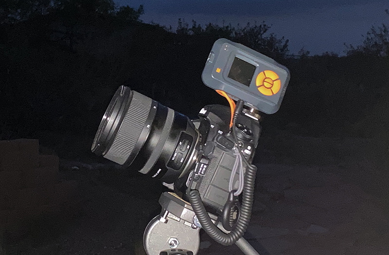
As this year's Monsoon Season was looking to be a good one, I ordered a MIOPS lightning trigger to assist with capturing lightning photos. It arrived on Wednesday. And just like when you get a new telescope or accessory and the sky clouds up, the arrival of the lightning trigger ended most of the lightning here.
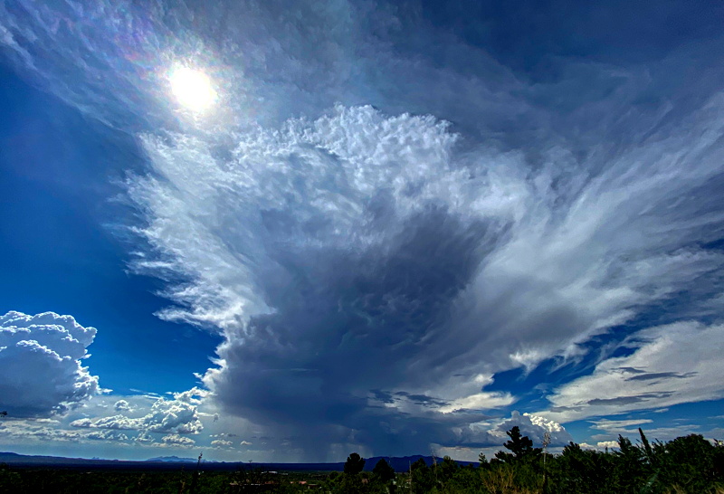
Late Friday afternoon, 16 July, a brief shower come through with 0.24" rain here. Saturday, 17 July, dawned mostly clear but clouded up mid-day, with continued Monsoon Season thunderstorms in the forecast for the next seven days (and nights). Sunday, 18 July, there was a brief shower after sunrise but only a trace of rain. Monday afternoon, 19 July, had a nice thunderstorm (0.26" rain in 20 minutes). This is the storm after it passed to the northwest (wide-angle iPhone photo).

Tuesday night, 20 July, a severe thunderstorm popped up very quickly in the east and moved westward, giving me a chance to finally use the MIOPS lightning trigger.

It worked wonderfully. Most of the lightning was embedded in the clouds, but it did capture some nice bolts. This is a merge of six photos (f/8, 2 seconds each, ISO 1600, FL 24mm).

The storm gave us another 0.13" rain.
After the storm moved off the west I saw that a webcam had captured a nice bolt in the western sky.


So I went outside again and took more photos using the lightning trigger. This is a merge of nine photos (f/8, 2 or 5 seconds each, ISO 1600, FL 24mm).

The Billings Montana Gazette has published the article "Stargazing gains followers, promotes tourism in rural regions", for which I was interviewed.
Comments are welcome using Email. Twitter users can use the button below to tweet this report to their followers. Thanks.
Cassiopeia Observatory Home Page
Copyright ©2021 Michael L. Weasner / mweasner@me.com
URL = http://www.weasner.com/co/Reports/2021/07/21/index.html
